
Dipper calculates field area from a satellite map or GPS points. Use the map when the boundary is clear; visit the field when it is hidden or the imagery is old. Display the result in acres, hectares or local units.
Measure the boundary
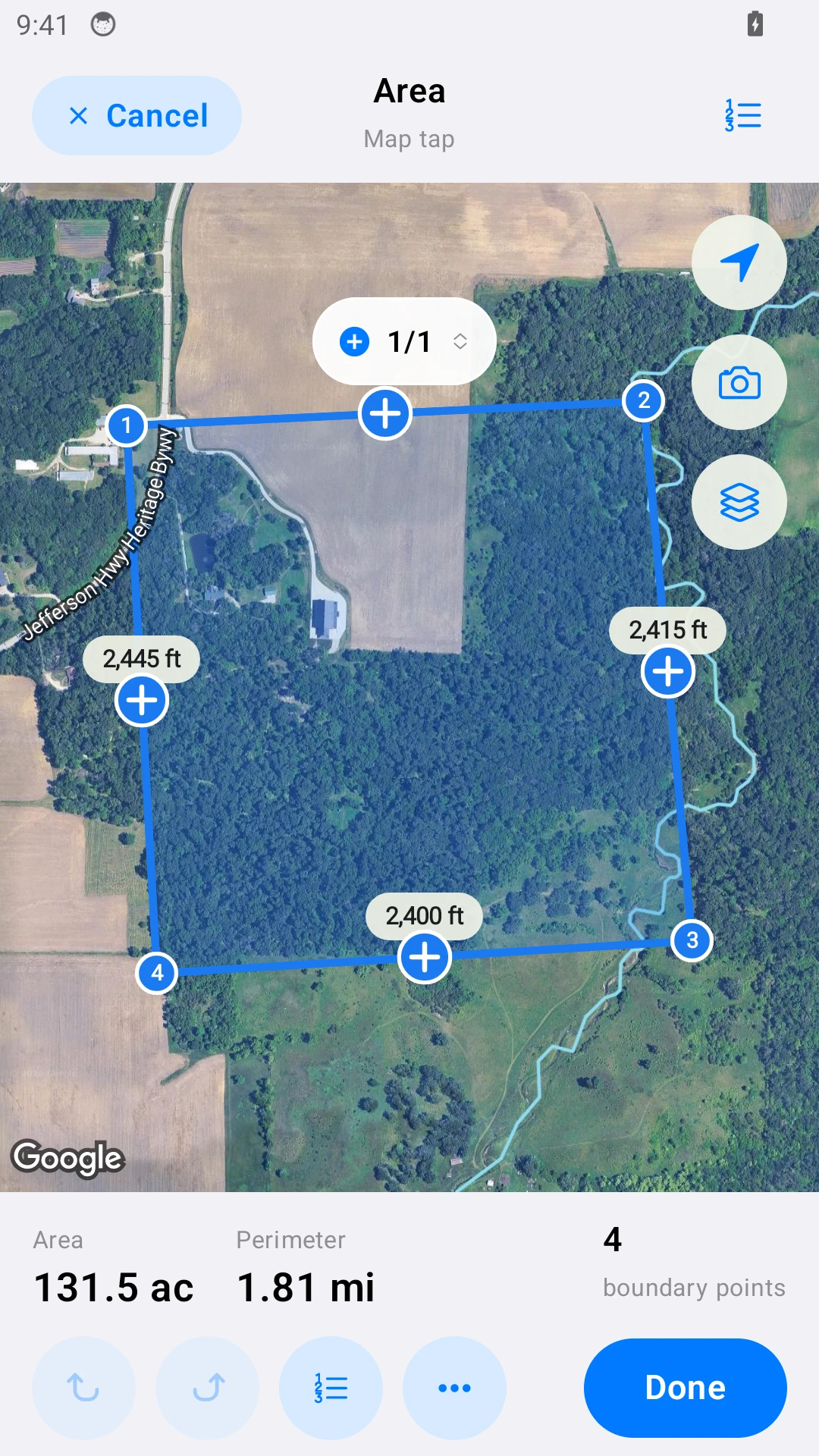
- Open New measurement and choose Area.
- Add each corner and each change of direction. Follow the ground boundary, not a shadow or tree canopy.
- Finish and check the outline. For a pond or building inside the field, see Subtract areas.
- Choose the area unit in Settings, then save the measurement with a name and notes.
Acres, hectares or mu
The same boundary can be displayed in different units. 1 hectare = 10,000 m²; 1 acre ≈ 4,046.86 m²; 1 Chinese mu ≈ 666.67 m².
Example conversion: 10,000 m² = 1 hectare ≈ 2.471 acres = 15 mu. These are unit conversions, not a field test.
Measure outdoors
Use Mark each corner with GPS for straight sides or Walk an area with GPS for an irregular edge. See GPS instructions and GPS accuracy.
Share the result
Export a PDF with the map and values. Note which method you used. The result is an estimate for planning, not a legal boundary survey.